
Event led by Andy H
Attendance: 15 men to start, 5 dropped-out during the walk (as happens in London, there’s bus stops everywhere), 10 ended the walk at the pub.
Distance: 10.2 miles
Time: start 11.06am, end 4.11pm, lunch 34 minutes
Terrain: Entirely on hardstanding
Elevation: start 90m, high 128m, low 13m
Weather: mainly overcast, moderate south-westerly winds, occasional sunshine, humid.
This was a circular route of 10.2 miles from Alexandra Palace, SW to Highgate, E to Finsbury Park, NNE to West Green, NW to Wood Green and W back to Ally Pally.
This walk was one of Herts GOC’s rare invasions of London, an event which generally triggers a huge outcry of the most indifferent apathy known to humankind. The route was entirely on hardstanding. The first half of the route demonstrated just how green London is, the second half demonstrated just how urban London is. As usual for a metropolitan walk, there was a lot of things to see, with art replacing nature in some parts.
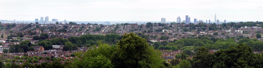
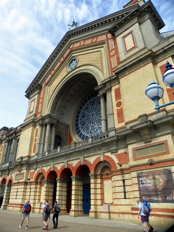
The route started at Alexandra Palace, leaving Alexandra Park on a SW route using Parkland Walk North. The starting point offered some tremendous views of the workaholic city of London - a clear air in spite of being a Grey Day - a wide aspect from ~90° to ~230°, offering views of Canary Wharf, the Olympic Stadium, the Square Mile (Tower 42, Gherkin, Walkie Talkie, Shard, etc), St Paul’s Cathedral, the London Eye, Strata SE1, the BT Tower, the Crystal Palace transmitter and loads of residential properties of just about all varieties Britain has ever built. As a result, we saw the geology of London. In the far distance, we saw the hills to the north (appearing in the east) and to the south, these hills representing the lip of the basin in which London sits.
Having seen the geology of London, we quickly found out that we were about to feel it. The route’s elevation (see numbers above) was unevenly distributed. The first half of the walk took place mainly on elevated ground, the same ripple of earth that created Parliament Hill in Hampstead. The second half of the walk took place on the floor of the Thames Basin. The route leaving Highgate went downhill to visit a cemetery, to return uphill again towards Finsbury Park.
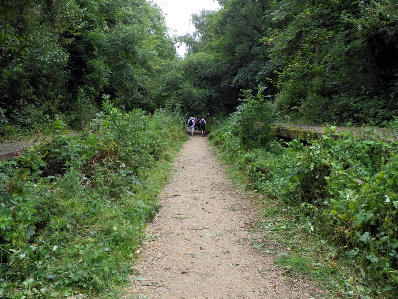
The Parkland Walk (map) is a disused railway. This was a surprise. Disused railways are ten-a-penny in Herts, but many of us had expected that London would have made use of railways as much as possible, especially considering how many railways London has built in the past few years. But apparently not always. Not even London Underground could find a use for the railway that became the Parkland Walk.
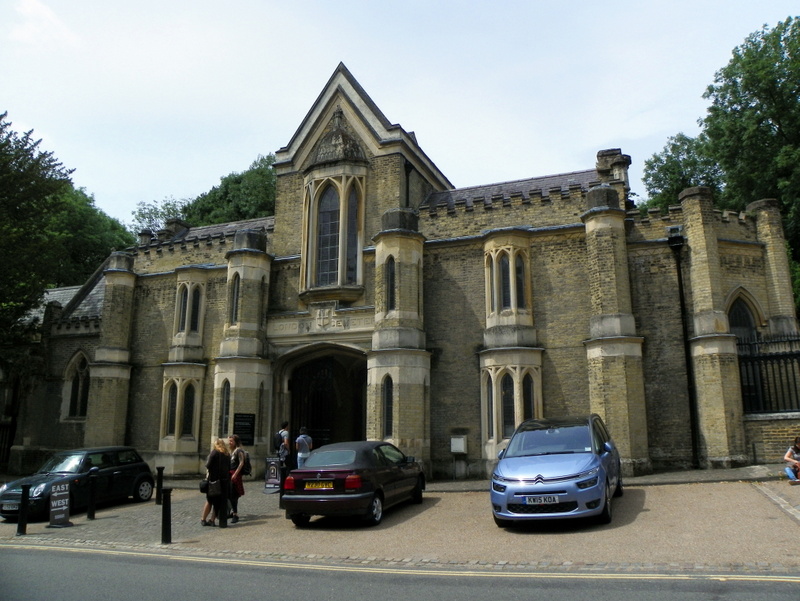
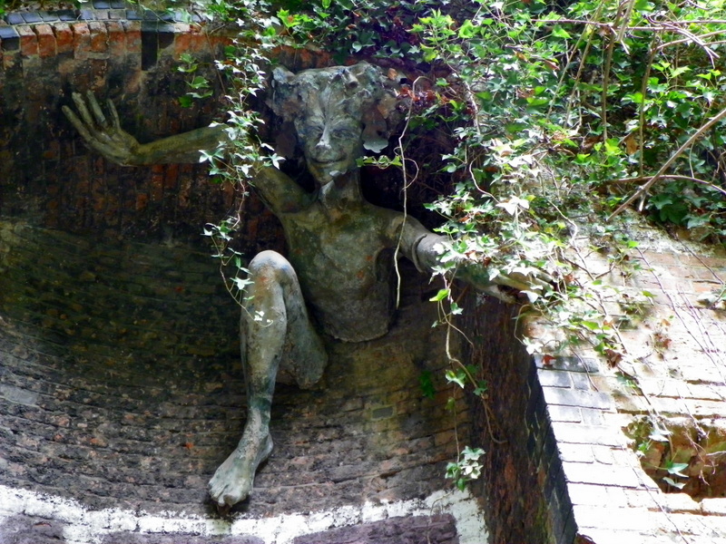
London continued to show off its greenery in Highgate Wood and Waterlow Park, with an optional brief visit for some of the group in Highgate Cemetery. In between green bits, we saw picturesque suburbia, including the nice bits of Highgate. Our route continued on the southern part of the Parkland Walk, this part being part of walk #12 [pdf] of the Capital Ring. This part features a sculpture of the mythical creature Spriggan, mounted on the wall high on the brick embankment close to the former railway station of Crouch End, Waiting For The Ghost Train. Spriggan was the inspiration behind Stephen King’s novel “Crouch End”.
One Step Beyond, our route continued to Finsbury Park, where we had lunch. Obviously, the planning of the route anticipated a view of the Park, but today we saw a rather bland green wall of chipboard, a hoarding that kept the Wireless Festival confined to the inside. We got the impression that two stages were blaring at each other. We couldn’t identify what the sound was supposed to be - music? earache? the cure for narcolepsy? - but we generally felt that this wasn’t really our type of music. As we left lunch, we did grab sight of a video screen, and it did seem to be a teenager screaming something into a microphone.
Leaving Finsbury Park took us over New River - London’s former water supply from Herts, now quite a stagnant-looking body of water - and then into a route of mainly suburban housing. This was Hermitage Road, home to Harringay Warehouse District, an experimental and controversial live-work zone in which creative industries sit alongside ordinary people’s homes, any one of which could have been Our House. Haringey Council only discovered this District in 2013 and, with it, illegal residential dwellings on industrial-use land, in spite of having received 10-years of council tax from the ‘illegal’ residents. What an Embarrassment. Shut Up! Aside from the politics of the situation, you’d never see commercial buildings like this in Herts, let alone be so close to residential dwellings. The District felt tired, run-down, not looked after, even dilapidated in parts, but the evidence of recent and regular activity was there, and at least one person was working there on the day.
As we walked past the houses in this area, we became slightly aware of some sort of referendum having taken place recently. One house even sported a handwritten scrawl on a piece of cardboard in favour of the European Union.
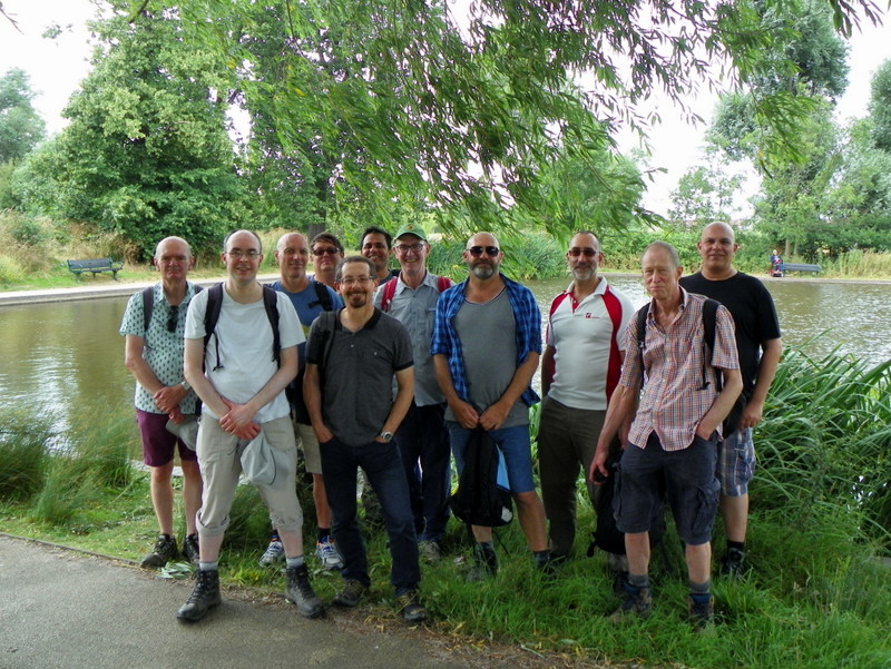
Our route continued into Downhills Park and then into Lordship Recreation Ground. The Lordship Recreation Ground featured the model traffic area, designed to be used by children to learn the rules of the road (i.e. cycling proficiency). We noticed that even the trees were scaled down to remain proportionate to the same scale as the roads, roundabouts and signs. Such attention to detail converts the model from a mere tool to something approaching a work of art. The Ground was extensively refurbished in 2009 and now features a paddling pool, a cafe and various apparatus (public gym equipment). By now, the sun had appeared, and the Ground was absolutely packed. This was a social environment very far removed from the same area known by non-Londoners as the riotous Broadwater Farm estate. Our group shot took place in the Lordship Recreation Ground.
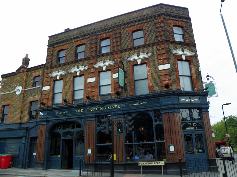
Our route continued through more metropolitan areas until we reached the pub opposite Alexandra Palace station, The Starting Gate, a pleasant example of a decent north London pub, serving good beer - including some innovative beers - and well-presented food.
The pub became the official end of the walk for most of us, except for our walk leader, four members who parked their cars in Ally Pally and the group’s ‘backstop’ man, who then climbed the virtual mountain from railway station to the elevated Palace. The elevation of the route was so uneven that the half-mile from pub to car park turned out to be the steepest ascent of the route. “I don’t believe this,” said our walk leader Andy H. “I’ve already walked up this hill once today…” Madness!
Pictures by Peter O'Connor. Words by Martin Thornhill and Peter O'Connor.