19Sep2026: Lee Valley, Docklands and Woolwich Royal Arsenal
Event Details

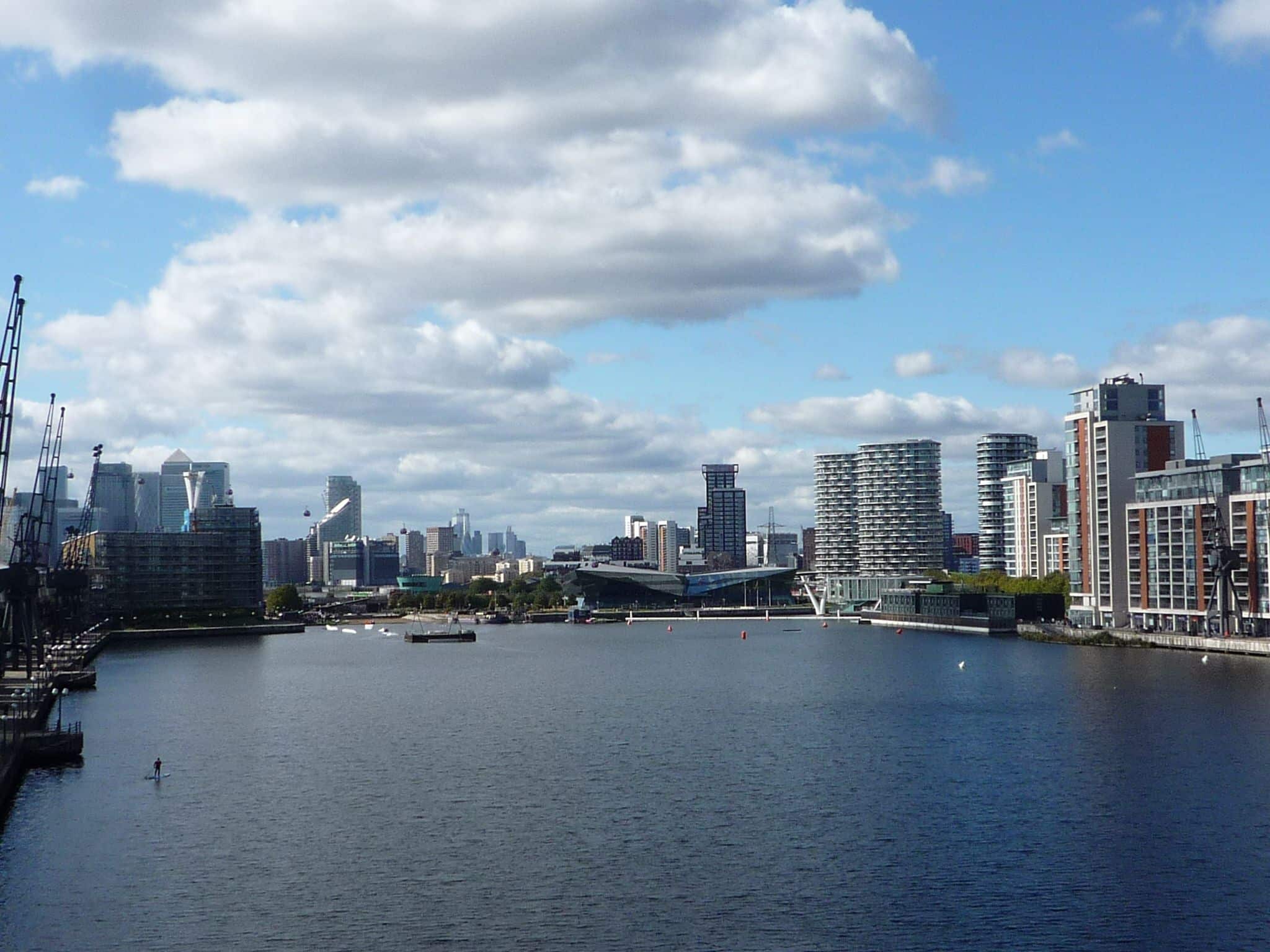
A superb, point-to-point flagship walk of 10.3m from the southern most end of the Lee Valley, at East India Dock, to the Woolwich Royal Arsenal, calling at Leamouth, City Island, Bow Creek nature reserve, Canning Town, Royal Victoria Dock, Silvertown, Thames Barrier Park, Royal Albert Dock, London City Airport, Gallions Reach (via Capital Ring 15), Royal Victoria Gardens and Woolwich Royal Arsenal.
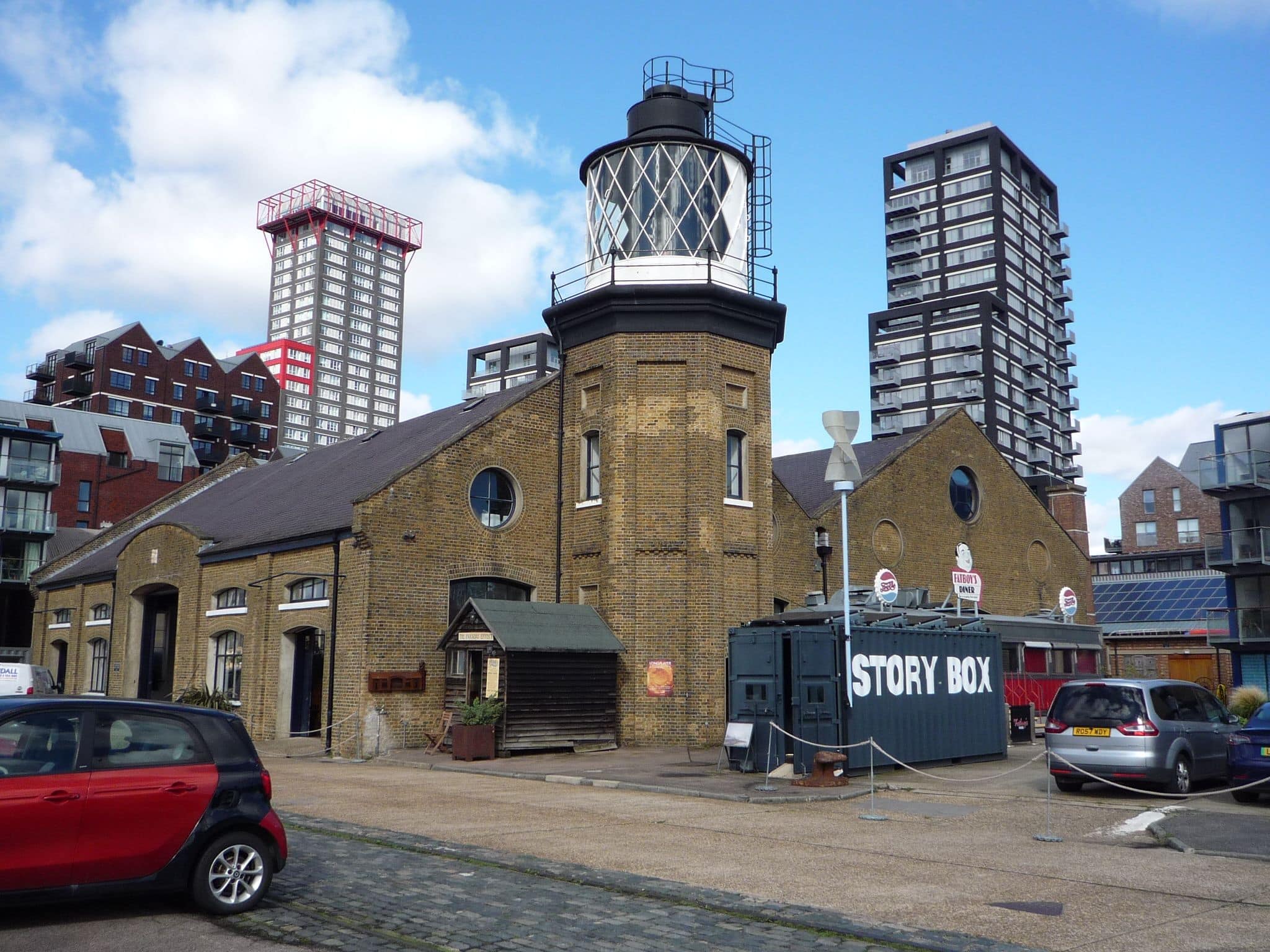
A flagship walk is one that best showcases an area. This route takes in a dazzling variety of London’s landscapes, ranging from corporate-glitzy concretia to post-industrial dockland, from parkland to mudflats, from busy roads to peaceful riverside, from nature reserves to bus stations, from sterile new residential neighbourhoods to dilapidated water defences, from rich to poor, from riverside paths to causeways, from walking over water to walking under water. Most of the route is well off the beaten track, providing an opportunity to visit some beautiful nooks and crannies of London, including a nature reserve that cannot be visited unless deliberately.
Along the way, the route takes in:
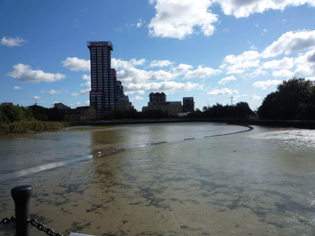
- the confluence of the River Lee with the River Thames*;
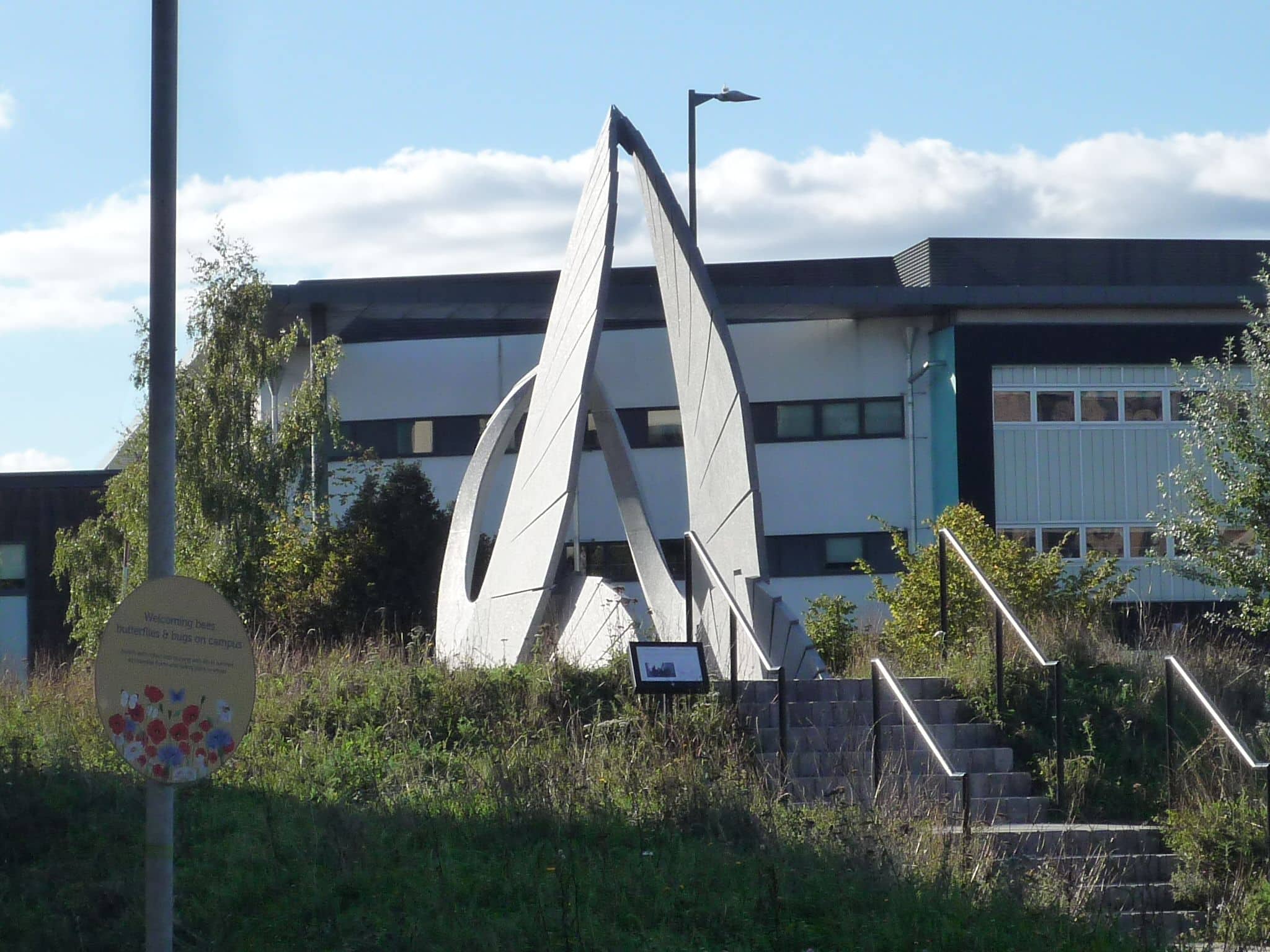
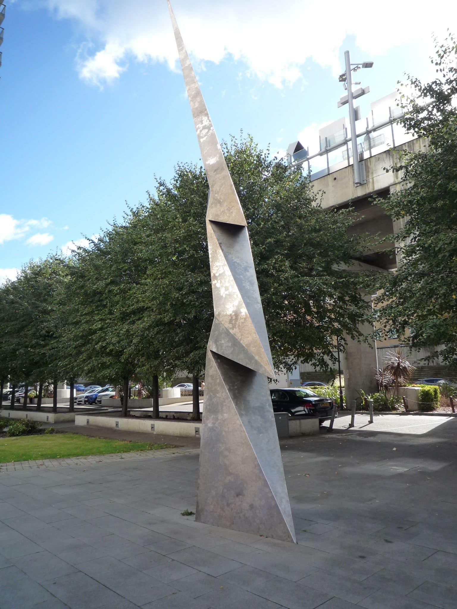
- loads of public works of art**;
- an ecology park;
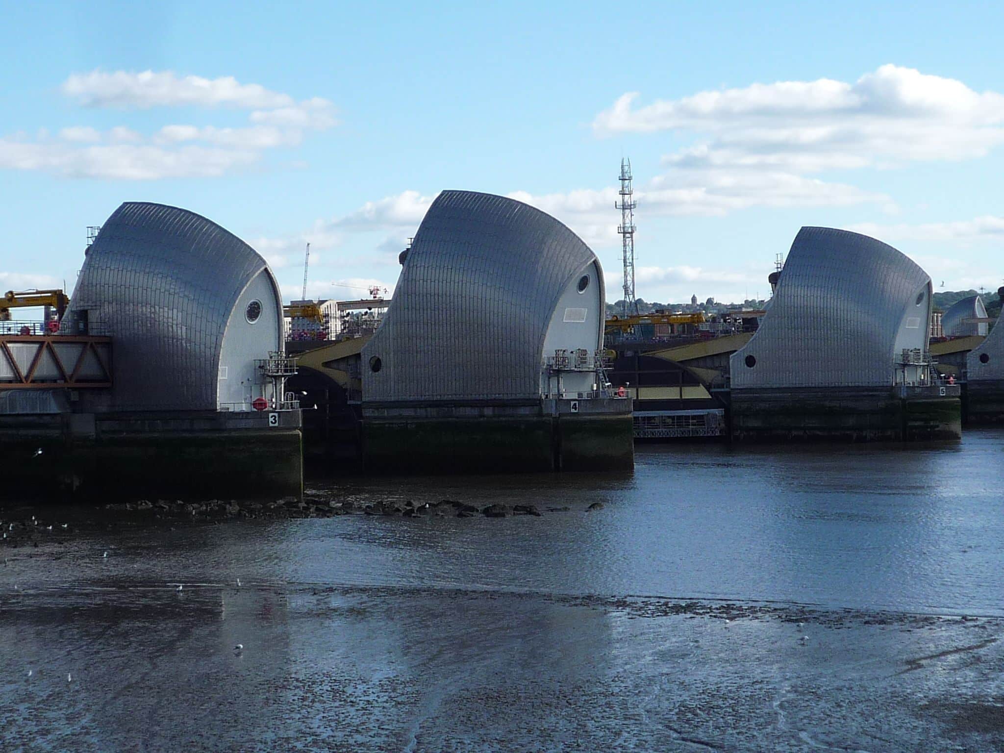
- a close-up view of the Thames Barrier;
- a modern urban village;
- views of Canary Wharf and the City of London from an elevated position above Royal Victoria Dock;
- views of the hills south of Woolwich;
- views of London City Airport;
- the tourtisty noise of ExCel centre versus the serene peace of the long blank march alongside the Royal Albert Dock (with the sun behind us);
- views from Gallions Point east and south-east (towards Thamesmead and Woolwich);
- beaches (mud-sand and pebbles);
- rich historical evidence of yesteryear’s industrial legacies, re-purposed by urban regeneration into today’s attractive environments;
- evidence of tomorrow’s opportunities for urban regeneration;
- two ferries engaged in synchronised swimming;
- ’planes, trains, boats and automobiles. And causeway and airports;
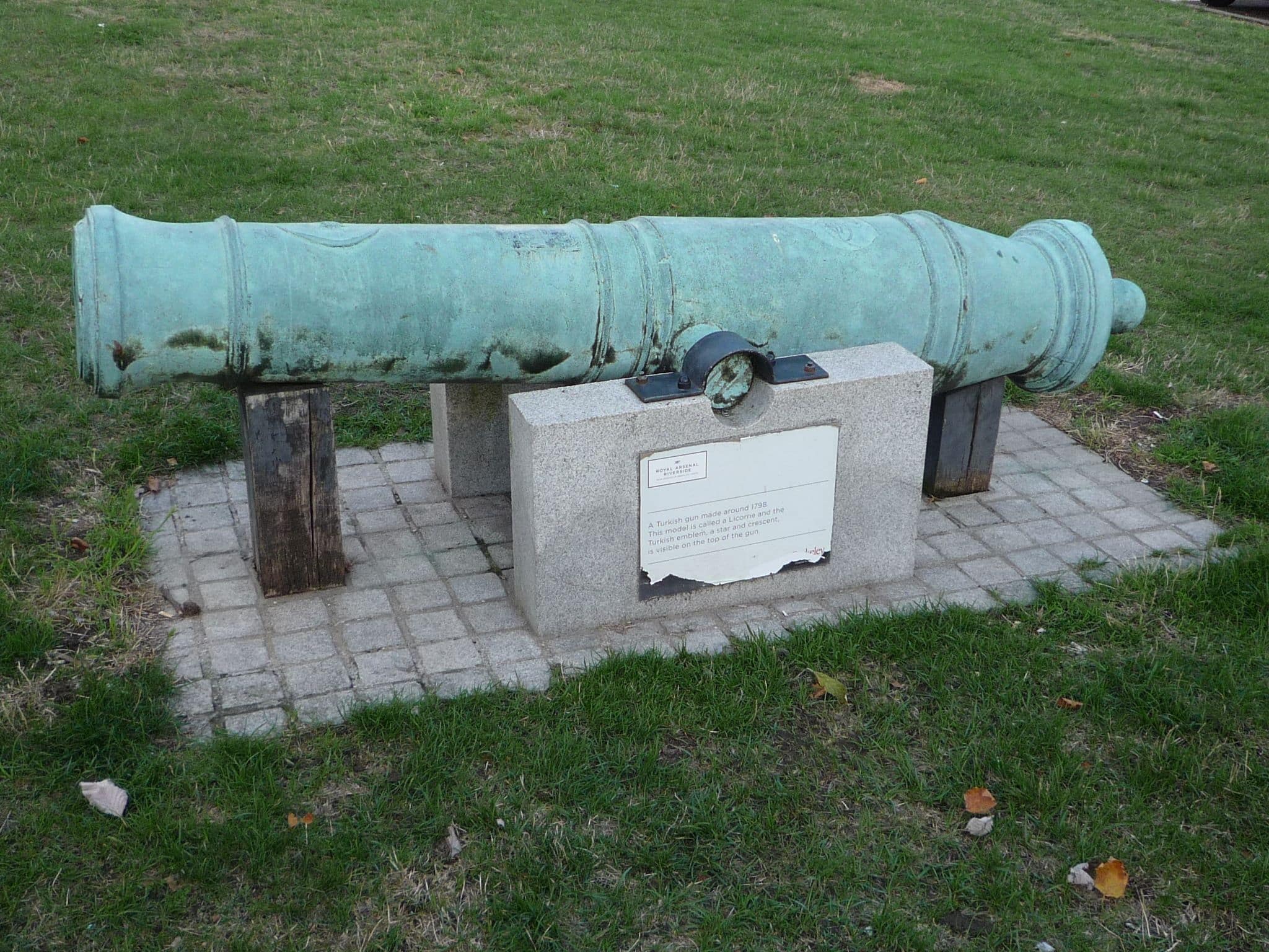
- And cannons. Because every London village needs a cannon. Or a few hundred of them, anyways.
The route is almost entirely on pavement, with ~20m of unavoidable grass to use to cross a lock’s gates. Other non-pavement routes are optional.
The route is wholly exposed, a lot of which is on flat land or alongside open water, so expect high wind gusts (especially at height). Wear windproofs and/or sun-screen and sunglasses as appropriate.
Wear sturdy trainers, sufficient for a 10 mile walk. Walking boots are preferred, but optional.
Bring packed lunch, a mid-morning snack and something to sit on. Lunch will be at a series of picnic tables close to a cafe. Lunchtime is later than usual.
The route uses part of the Capital Ring, which London GOC explored comprehensively a few years ago.
Gephyrophobia is a fear of bridges and tunnels. There are three opporunities for gephyrophobia on this walk. The first is a bridge high over water. The second is a long tunnel underneath the Thames. Both have alternative routes: the former has a walking route alternative and the latter has a ferry*** interesting alternative (geddit?). The third is a gap of 30cm between two doors of a lock. This third opportunity is not so easily avoided; a walking route looks possible on the map and is not tested for this walk.
The route is geographically on the flat – broadly at sea-level – but, in reality, there are hundreds of steps up and down at numerous locations, tens of meters above and below sea-level. Alternative routes are available, as set out in the paragraph above. To coin a phrase, there is no step-free access on this walk.
There are a few public toilets on the walk, three up to lunchtime and one after lunchtime. In most cases, there is neither soap (!) nor hand drying facilities. The nearest toilets to the start point are at Canary Wharf (Cabot Place, Crossrail Canary Wharf, near a food court).
Optional pub stop at the end of the walk. See also the separate event for an informal dinner.
Notes:
* The southern most end of the Lee Valley is where the River Lee meets the River Thames at Leamouth, through Bow Creek. By contrast, the River Lee Navigation diverges from the River Lee at Bromley-By-Bow, travels through the Limehouse Cut to Limehouse Basin, there joining the River Thames. The Limehouse Basin is visible from edge of Rotherhithe.
** For the avoidance of doubt, this walk is not an art walk.
*** In reality, the ferry takes much more time to use than to walk in the tunnel, so we will not be using the ferry on the route.
Full details are available to members only

Ready for another adventure?
GOC Shop
From hoodies and t-shirts to bags, bottles and bears - show your love for GOC with our gear from Spreadshirt.